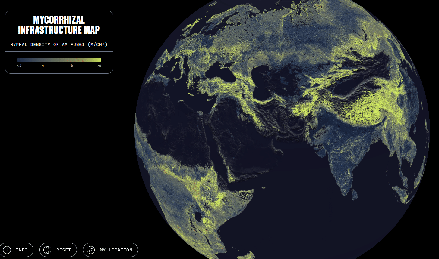
Interactive Map Illustrates Earth’s Arbuscular Mycorrhizal Fungal Networks
The Society for the Preservation of Underground Networks (SPUN) has released an interactive map that helps illustrate the enormity and distribution of Earth’s arbuscular mycorrhizal fungal networks. These networks transport carbon, nutrients, and water throughout underground ecosystems. The map is based on research by an international team led by SPUN researcher Justin Stewart and Corentin Bisot of the AMOLF Physics Institute. SPUN explains that the data captured in the map can help scientists and decision-makers begin to determine which of these vital fungal systems are thriving, which may need help, and which clearly need more sampling. The map reveals that the highest density of arbuscular mycorrhizal fungi, on average, appear in wild grasslands, while large-scale agricultural crop lands are predicted to be associated with about 50% lower network densities.